Upper Lucumayo River: IV+

Zak on the Lucumayo
Following our Mapacho expedition, we had a long journey back to Cusco. The last leg of our journey was an afternoon bus from Quillabamba to the big city. The route took us further up the wide Urubamba River for an hour or so before the road splits off up a side canyon to go over a pass. Driving up this tributary, we were all pretty intrigued to see lots of continuous, apparently runnable whitewater. By the end of the week we did our research and returned to explore this section river: the Lucumayo.

Looking down on the continuous rapids
Our plan was to get on a bus headed downstream, wait until the boating and access both looked good, and have the driver stop. From the take-out we had further plans to travel to Santa Teresa for a week of clear water creeking. With no place to stash our gear, this meant we´d be paddling loaded boats yet again.

Mikey boofing away
We found the town of Incatambo to be a pretty ideal put-in. The river was about a quarter-mile hike from the road down a good trail and we found ample flow even in early November before the rains had started. The combination of a late start, a long drive, and gearing up slowly had us pushing off at about 3 p.m. It gets dark here just after 6, but we expected the run to be only two hours.
From the very beginning, the river moved fast and steep over boulder bars with few eddies. We were leap-frogging our way downstream through great class IV water with no opportunities to rest. Although the gradient seemed to be around 200 fpm, the canyon was fairly open with great visibility, and we could read-and-run everything, usually just following the helmet in front of you.

The first several kilometers went by extremely fast without any scouting. Occasionally we all stopped above a horizon line and let Kase probe away for us through the class IV+ drops. After an hour of making quick progress through great continuous rapids, we all regrouped to go over the beta we had.

Dave above another junky boulder garden
Nothing was written down. Someone remembered hearing about two bridges. Someone thought the river was supposed to present a couple class V rapids. We all knew there was a canyon below with unscoutable sections. Was it between the bridges? Just below the bridges? Class IV or V? How far did we think the take-out was again? How were we going to recognize it? Maybe I should have taken better notes.
As we pushed on down river, the Lucumayo retained its character. If anything, the channel got wider (shallower) and steeper. We started pinballing off rocks more and more often. Some of the drops certainly seemed on the verge of class V and our progress slowed. Kase was still eagerly probing, but the rest of us were hesitating above the big rapids more and more. We weren´t scouting anyway, so none of us could tell if the rapids were unscoutable. Eventually we ran one last steep class V- just before passing under a concrete bridge. Was this our take-out? If not, everyone seemed to be feeling done anyway. It was after 5 p.m., so right on par with our two-hour estimate. We all got out and passed out boats up to the ¨road.¨

Kase in some of the steeper stuff
Just then, a local kid came by on a motorcycle. He told us that we weren´t as far as we´d thought. From here it was a one-hour walk to town, and that was without carrying awkward 90-pound boats. Furthermore, we seemed to recall reports saying that below this bridge, things opened up again and it was a short distance to the take-out bridge. Our boats went back down the the river, and we went in them.

Mike in boogey water as darkness encroaches
The next kilometer was some of the best paddling of the day. Once we were all ready, we pushed off again and boogied through clean, continuous class IV rapids with plenty of fun moves and very little boat abuse. We eventually regrouped above another horizon line. Kase probed, then Dave disappeared. I couldn´t see either of them and the coming darkness didn´t help any. Mike and Zak got out to scout and relayed hand signals to me from shore.
Going off of beta, I cruised on down the right side of the rapid into the pool below. Then the rapid kept on going. And going. With poor visibility, I was making last-second strokes to avoid rocks and punch holes. The river was certainly not getting easier. Once in an eddy below the suprisingly big drop, I looked around with concern. The river had just channelized into a steep rapid with big boulders. I didn´t see any of the valley alluvium that had been typical of the last 8 km. It was getting dark, and the river seemed to be entering a gorge. The next rapid looked fine, but around the next corner was unscoutable.

Looking into the first rapid of the canyon
Once everyone was in the eddy, the discussion turned into an arguement about what to do next. We scoped out a meager beach on river left and determined that it would do as camp for the night. Good thing we had all our overnight gear. We scrambled around like five people cooking in a small kitchen for a while and eventually had two tents set up, a stove cooking, some candles rigged for light, and dry clothes. Sleep came easily.

Our über-spacious camp
The next morning we had one of our slowest starts yet. Several cups of coffee, a yoga session or two, dry out the tents, and plenty of solo missions into the surrounding jungle to fertilize the soil. Then began the discussions of hiking out. Mike´s shoulder was bothering him and Dave and Kase were tired of smasing their boats on rocks. Without our all-star probes I was unsure about the unscoutable/unportageable rapids below which left Zak to run it solo. The hillside across the river was exposed, but climbable and free of vegetation. Then somewhere up there was the road. It was a serious consideration until some rocks broke free from 200 feet up and trundled down to the river, ranging in size from limes to soccer balls. I guess that option´s out!
We finally got all our gear together and put on as a group of five. The first two rapids of the gorge were scoutable and we quickly got back in rhythm for the day. The third rapid had us in eddies out of view of eachother and after a confused barrage of whistle blasts, we were all smiling in a big eddy. Just below a creek came in on river right, the same side as the road. Talk of hiking out started again.

This time Mike and Dave decided to abandon the canyon for the road while Kase, Zak and I kept going to the planned take-out of Amaybamba. Dave gave us directions for the rapid below and our group of three disappeared around the corner.
Kase, Zak and me as the group splits up
This time Mike and Dave decided to abandon the canyon for the road while Kase, Zak and I kept going to the planned take-out of Amaybamba. Dave gave us directions for the rapid below and our group of three disappeared around the corner.

Drifting through another canyon rapid
The gorge continued for a kilometer or so with several more open sections punctuating the unscoutable rapids. Once again, Kase probed everything and I read his hand signals more than the water. While the boxed-in nature was intimidating, the rapids were all class IV and the gorge was by far the most beautiful part of the run. The walls would often rise 50 feet out of the river and the banks would be connected by the jungle canopy overhead creating a shady tunnel for the river. I´m glad we weren´t running it in the dark.

Such a beautiful place!
Below the canyon, the river resumed its bouldery nature with plenty of scraping and crunching. We bumped our way down to where a road came to the river and called it a day. A bridge was right around the corner and serves as a good land mark for the take out, but requires a slightly longer hike. We chatted for a few minutes with locals who were shovelling gravel into a truck or something, but didn´t seem to want to give us a ride. So we shouldered our boats and began the long hike up to town.
When Peruvians put a road in a river canyon, they have a slightly different vision than American highway engineers. Nothing is truly roadside in Peru. Although the road does parallel the river, it was still several hundred meters above us. We were certainly taking our time and snacking on the way out, but it still took us over an hour to reach Amaybamba. The main thought keeping us moving slowly was that of Mike and Dave, who had chosen a route sure to be far more brutal and slow. When we finally reached town, the first stop was the lawn outside a store with plenty of beer. Suprisingly, we only had to wait an hour or so for the other two guys to return from ¨one of the most hateful things [they´d] ever done.¨ We waited far longer to get a ride to the next town.

Things ain´t so bad at the take-out. Drinking beer waiting for someone to do something.
For anyone thinking of running the Lucumayo, this is NOT the way to do it. It should be a day trip, not an overnight. You should paddle empty boats to endure much less rock bashing. The best place to base out of is probably Santa Maria, 15 km or so downstream where the Lucumayo enters the Urubamba. Alternately, you could base from Quillabamba where hostels, supplies, and transportation are more abundant, but it´s another hour down the road. The other logistic to try to work out is the take-out. It´ll be better with empty boats, but the hike still sucks. Try to find a car to pick you up.
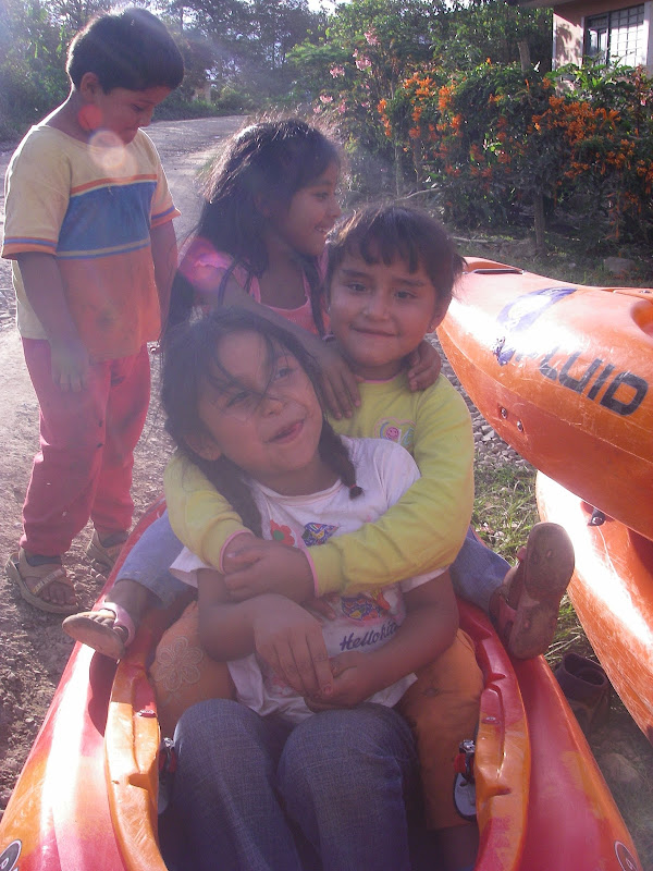
Parting shot of local kids playing in the boats:
 |


Comments
May I include one of your photos of the Lucumayu river in a video? The video is about Alfamayo, a town located in the Lucumayo valley. I am a musician from Cusco. Please contact me for more details. Thank you.
Daniel
danzamalloa@yahoo.com