First known descent from Elk Creek to Red's Horse Ranch
Mike Thurber on the Upper Minam Photo: Leon Werdinger
The logistical ninja for this mission was an unlikely suspect: my father, John Thurber. And a huge thanks goes out to
Leon Werdinger for taking all the great photos
Growing up in La Grande, Oregon, the Eagle Cap Wilderness area was our local craggy mountain range for all those silly activities that draw people into the mountains. My dad, brother and I would fish, camp, and hike in many of the glaciated valleys draining the high granite and limestone peaks of the Wallowa Mountains. Once I became a kayaker, I always wondered what whitewater gems might lie in this area that seemed so geologically similar to the creeking mecca of California's Sierras.
Like many before me, I have scouted several of the drainages on foot and concluded that hiking mile-for-mile upstream in most drainages would never be worth paddling the manky wood-choked streams that flow back to the trailhead. But the largest river to flow out of the Wallowas is also the most remote. The Minam River flows over 50 miles through the wilderness area and several miles through rangeland before its confluence with the Wallowa. Twenty-two miles upstream of its mouth, the Minam passes the only airstrips in the entire Eagle Cap Wilderness area at Red's Horse Ranch and the Minam Lodge. With these access points, the lower section of the Minam had been run several times and even rafted commercially for a short while. I must assume that someone had floated the section upstream, but we were unable to find any information about the first descent or any reports published by the earlier explorers. So I suppose we can call it a first
known descent
Photo: Dan Thurber
So after extensively studying the topo maps and conferring with local horsepacker about access, John settled on the confluence with Elk Creek as our launch point. We arranged for two mules to carry most of our supplies and make the long hike in a little more manageable. In the morning, Mike and I made it to our parents' house in La Grande, finished loading the truck, and were at the Buck Creek Trailhead by about 2 p.m.
discussing the finer points of our backpack systems. Photo: John Thurber
Our plan was to knock off the first eight miles of the hike and all of the climbing on the first afternoon. John and Leon were taking IK's for the trip and thus able to send them in on mules, so Mike and I were carrying our boats and camping gear, while John packed in all the food we would need for the night. After about 3 hours on the trail, we reached Burger Saddle just as the sun was going down and found a campsite for the night.
Mike and the author at Burger Saddle, 6 p.m. Photo: John Thurber
Day 2
Having knocked off the toughest part of the hike, we had a very casual pace for the second day. We got back on the trail and descended into the Elk Creek drainage for another seven miles before arriving at a nice bridge over the Minam in the early afternoon. The trip had intentionally been planned for mid-summer to achieve a low flow, so Mike and I were expecting a pretty dismal view of the river. To our delight, the river was well-channelized with about 130 cfs and at least for the next 50 yards was deep enough to paddle cleanly.
Camp at Elk Creek before launching. Photo: Dan Thurber
The rest of the day was spent fishing, swatting mosquitoes, and waiting for Leon to join us. I ventured upstream about two miles to see if the river looked fun enough to hike the boat up a little further. I only bushwhacked to the river once, but saw three logs and very little gradient. I decided I could hold off paddling until the next day.
Mike enjoying a nice shady ponderosa. Photo: John Thurber
Day 3
It took quite some time to divvy up the loads and we got a late start at 11 a.m. The river quickly widened and got shallower, with the IK's getting stuck often and us kayakers leaving a fair amount of plastic on the riverbed.
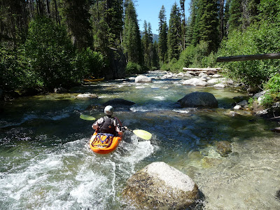
The author negotiating a particularly bony stretch. Photo: Leon Werdinger
Bouncy cobble bar riffles were punctuated by deep, serene pools that made us just want to swim and fish in the hot weather.
Photo: Dan Thurber
The mellow gradient got steeper for about a half-mile right around the confluence with Last Chance Creek. The river was so continuous that it became hard to distinguish any particular rapids.
Leon leading downstream. Photo: Dan Thurber
Overall, we were pleasantly surprised by the lack of wood in the stream. After about 3 miles, we came upon a monstrous logjam in a mellow section and were forced into a quick and easy portage on river right. Studying the topos for the river, we knew we could expect more of the mellow gradient until the confluence with Rock Creek, where the river appeared to steepen to over 80 feet/mile.
Photo of Leon by Dan Thurber
We cautiously progressed into a steeper section as the evening settled in on us. For the first time in the trip, we saw bedrock and something resembling good whitewater. But with the sun setting, we took no time for pictures and worked our way downstream in search of a good campsite. After a half-mile, we exited what we dubbed the Twilight Gorge and were back into chunky boulder gardens. Just around the next couple of corners, we spotted a beach on river left where the river began to steepen again. Our campsite came just in time.
Photo: Leon Werdinger
Day 4
Our biggest day on the water got off to a swift start right off the bat. We were faced with a half-mile of steep boulder-garden that John named "Soggy Britches" after a brief swim. The river continued to drop at about 100 fpm right up to the first horizon line of the trip. Around a right-hand bend, the river disappeared over what turned out to be a class III slide. Some of these steeper rapids were a little above John's comfort level and Leon wanted to get lots of pictures, so Mike and I happily ran the final slide of Soggy Britches twice: once in hardshells and once in duckies.
Mike at the bottom of Soggy Britches. Photo: Leon Werdinger
We continued boatscouting the next couple of miles as the river dropped through more chunky but navigable boulder gardens. At times John and Leon would hop out and line their boats around strainers or especially technical sections, but Mike and I were able to stay in our boats with some creative log ducking and wheelchair boating.
John lining the entrance to Kayak School. Photo: Dan Thurber
Soon enough we arrived at one of the best rapids of the trip. A steep, clean lead-in rapid fed into a short bedrock gorge with several short drops. Mike probed and Leon got set to take pictures. Once John lined the entrance, he got back in his boat to paddle the toughest rapid we'd seen yet. He followed right on my tail for a good clean run through what we dubbed "Kayak School."
Photo: Leon Werdinger
Most of the day was a blur of bouncing our way downstream through cobble bars that would have been much more fun with more water. Mike and I took turns boat-scouting and usually giving the OK signal to Leon and John behind us. For the tougher sections, we got into a steady routine of running in two groups and either Mike or I taking turns hiking back up to run John's boat through while he hiked the conveniently located trail until things mellowed out. One section stood out as the steepest whitewater of the day and we named it the Fuck-All Boulder Garden.
The FABG started with a huge boulder on the right and then the entire river seemed to just siphon out into foot-wide slots. I probed away down the left side until things started to look grim. Then, somehow, my boat just seemed to lift up and bounce over dry rocks into the right channel where there was more water. In the middle of this half-mile section was a single fun ledge. Otherwise, the FABG was just miserable. We stopped halfway through to have a snack and then got back to work abusing our boats.
After the FABG slowed and the gradient tapered off, we were able to make some quick miles. Looking at the topos, I was optimistic that we had cleared the steepest sections and would be paddling flatwater until we reached the horse ranch late afternoon. Sure enough, the river meandered through beautiful meadows
Photo: Leon Werdinger
...then dropped abruptly over the biggest horizon line yet.
Photo: Leon Werdinger
We got out to scout as the river disappeared into a tight bedrock gorge. The entrance slide dropped about 15 feet and we could tell there was plenty more gradient downstream. It was worth scouting the entire gorge before dropping in, especially considering that it was getting late.
We decided to call this section the "Don't Forget Gorge" with each rapid named after the things you want to remember on any well-done self-support kayak expedition. The first rapid we dubbed "Good Beer Falls" in tribute to the 12-pack of microbrews Mike had stuffed into his bow.
Mike on Good Beer, round one. Photo: Leon Werdinger
I went first with a fun boof on the left side of the first ledge, then cut across to run the cleaner right side of the second slide. Mike chose to go right the whole way.
The author on Good Beer Falls. Photo: Leon Werdinger
After clean runs in our hardshells, we went back up to run duckies through. We each felt good about our previous lines and Mike went first with a smooth run. I started down off the first ledge and quickly was reminded that duckies don't boof like creekboats. Where I had previously cruised right past the backwash of a ledge hole, my bow this time got sucked right in. So there I was, sidesurfing a fully-loaded inflatable kayak in a sticky hole right above a potentially sharp and shallow slide.
A less inspiring run the second time around. Photo: Leon Werdinger
Fears of broken legs were running through my head as I braced downstream and wrestled my way to either side of the hole. Thankfully, the boat had thigh straps and after about 10 seconds I found a weak point and paddled out of the hole to a clean run over the bottom slide.
Next up was "Summer Sausage," another fun couple of bedrock ledges that wasn't nearly as eventful as its predecessor. The third rapid was "Wag Bag," because at first it was really clean, fun, and looked like a great idea. But in the end, it was completely full of shit. At the bottom of a cool-looking fast S-turn, the river flowed over two low-head dams that appeared to be made of logs across the river with slats nailed to them. They both looked fairly runnable, but the second one had a terminal hydraulic if you didn't clear it and there was no way to set safety. Besides, I kind of have a rule against running anything man-made, so the portage began.
Mike and I ponder the wooden dams filling up the Wag Bag. Photo: Leon Werdinger
John and Leon elected to just portage the entire gorge, but Mike and I wanted to run the rest of it, so we took the time to carry our boats up to the top of the gorge, walk around Wag Bag, and rope our boats back down at the first good opportunity. The sun was in our eyes as we ran the last two rapids, which we'll call "Flip Flops" and "Bug Spray" respectively. We quickly exited the gorge and met up with the rest of the crew.
Photo: Leon Werdinger
It was starting to get dark, so we wanted to find ourselves a camp as soon as possible. The day had worn on all of us and we looked forward to dinner and dry clothes. We went charging around the next couple of corners and before we knew it, were once again in a steep boulder-garden with few eddies. Things got fairly chaotic as we all went scrambling for eddies. We were going sideways, backwards, bumping into each other, and kept getting pinballed back into the main channel by unseen boulders, but eventually we were all able to stop. Getting so out of control and congested without knowing what lay downstream had been the most heart-racing moment of the trip. Using better spacing, we carefully hopped our way to the bottom of this rapid and called it "Don't Tell Mom."
Right where we pulled over was a conveniently flat bench in the trees and we called it a night.
Photo: Leon Werdinger
Day 5
This time, we really were done with the rapids. From our campsite below Don't Tell Mom, we paddled easy class II for a couple miles before arriving at the nice bridge and Red's.
Photo: Dan Thurber
We took a quick break and Mike went into the lodge to re-up our beer supply, but got back on track soon as we had only covered a third of our 45 miles. Luckily, Red's Horse Ranch marks a geologic change in the river where it flows out of the granite bedrock of the Wallowas and into Columbia Basalt flows more reminiscent of the Grande Ronde river canyon.
Photo: Leon Werdinger
This meant less gradient and less character to the river-bed, and we really didn't have any more memorable rapids. Just below the ranch we had a couple quick log portages but then started making mileage.
Photo: Leon Werdinger
The river was still a bit chunky, but we didn't suffer anymore pins and didn't eddy out except for lunch and camp. We scored on a slightly developed camp on the right at the mouth of a creek. The following day we woke up and paddled just a couple more hours down to the take-out at Minam State Park.
Photo: Leon Werdinger
Conclusion
We had a gage reading of 350 cfs on the Minam. At that flow, the river is certainly navigable, but very very scrapy. It reminded me somewhat of a less steep
lower McCloud. I didn't put any gouges in my boat and wouldn't worry about breaking it, but it got lots of new scratches. Being upside-down at almost any point on this run would be very unpleasant and if I were to do it again at these flows, I would probably rather paddle a ducky. With significantly more water, I think this could become a somewhat classic run. The Minam is a spectacular river and may offer the best paddling in the Wallowas. Access is certainly a challenge, but you just have to look at it as part of the expedition. The hike is on a well-graded trail maintained for horses and you get beautiful views of the Grande Ronde and Powder Valleys as well as craggy summits in the Eagle Cap Wilderness. I would first go back in at 20 cfs with a bunch of dynamite and get those damn dams out of Wag Bag. Then I'd go back in at 1000 cfs and plan on a 2-day trip and a rocking good time of class III-IV water in the most beautiful corner of Oregon.
Photo: Leon Werdinger


Comments
btw Eagle Creek on the south side of the E. Caps is pretty fun, and the flooding this year flushed a lot of inconvenient wood out. There is a lot of that creek that I haven't investigated yet though.
Have you ever run the Imnaha?
He said: "no i never did the minam, but i'm positive it was done years ago most likely by gary lane in riggins who used to live in cove. i'm certain too someone packed in with horses around 15 years ago and ran it."
Just thought you might be interested. Excellent write up btw.
http://www.fishlib.org/library/Documents/EnvSurvey/pt1wallowa.pdf
Jason Shappart
Wondering if you could provide a brief report on the fishing. We're you able to find some trout of reasonable size?
Thanks,
Charles
www.alpackarafts.com
--chris
I hope this blog is still active.
What time of year did you run this river? I'm itching to float it next year; I'm just curious as to how long into the summer season the navigable flows last.
Ian
I hope this blog is still active.
What time of year did you run this river? I'm itching to float it next year; I'm just curious as to how long into the summer season the navigable flows last.
Ian