Upper Clear Creek, Klamath Drainage: IV+/V

This run deserves an awful lot more attention than it gets. Maybe it's because of the one-mile hike in or the nastiness of the mandatory portage. Maybe it's because it's so far from population centers and doesn't have any granite, which makes California boating so good. Whatever the reason, it isn't good enough to not run Upper Clear Creek. The run itself is fairly short (3.5 miles), but with a gradient of around 165 fpm, there's plenty of action. And if you prefer to just bomb through stuff, you could either do laps or continue on to the mellow lower run (class II/III) to cool down.
 A view of the gorge from the shuttle bridge
Gabe lining up for a boof early in the run
The name Clear Creek suits the water quality, which is almost as transparent as a swimming pool. You can see the riverbed clearly throughout the run, even in pools that are 25-feet deep. The volume of the "creek", however, is bigger than many rivers out there. Clear Creek doesn't have a gauge, but is closely correlated to Indian Creek at Happy Camp, the next drainage over. In general, Clear Creek carries slightly more water, but locals just refer to the Indian Creek gauge. At 600 cfs, the run is a bit more creeky with lots of boofs and more sieves than keeper holes. At 900 cfs, some smoking holes develop in many rapids, a few of the pools flush out, and it gets pretty pushy in general, but almost all the sieves cover up and the run gets softer. Running Clear Creek at high water is like taking all the hero lines on the Cal-Salmon at 5.5 feet.
As of spring, 2007, the road was gated about a mile upstream of the take-out. The hike in from here takes about 45 minutes and is well worth the effort. Plus, it means you can walk your entire shuttle.
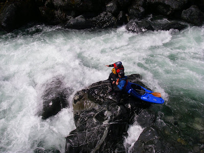
 Cyrus on a sketchy part of the hike in.
 Gabe and Adam scouting halfway through the first rapid
 Glenn just above the third rapid
The fourth is the hardest and final rapid in the first gorge. At high water, this one is class V, with three big holes to punch through and undercuts all along the left wall to avoid. At lower flows, all the holes mellow out and the last drop is an auto-boof with a narrow landing. A partial portage is very manageable along the right bank.
 Cyrus dropping in to the second hole, dodging undercuts

 Which slot would you like to get broken in?
 Cyrus sneaking left at The Frowner
 One of many river-wide foam piles on Clear Creek

The portage: I wouldn't be surprised if there are some
trees/dead animals swirling around down there.....

Gabe seal launching below the portage
 Fortunately, it all goes (eventually). The general run is left, right over the big ledge, left, then center. The big ledge gets a big hole on the left side that's a good 8' boof below 800 cfs. On to the take out.
 Light at the end of the gorge
Access:

My car was almost small enough to squeeze underneath it.....
Take out: Iif you plan on doing the lower run as well, park a car along Hwy. 96 where it crosses over Clear Creek (six miles downstream of Happy Camp). Otherwise, drive another mile upstream on the highway and turn off onto Clear Creek Road at Wingate Bar. A sign for Slippery View River Access marks the takeout of the upper run, put-in for the lower run. Hike down and scope out the take out, because it's hard to recognize. Also drop off your victory beers here so they get nice and cool.
 The fruits of good planning
As you continue upstream, you may want to stop about 300 yards above Slippery View and scramble down to scout the last rapid. It's unportageable, mostly unscoutable, and the biggest rapid on the run, so it's good to have some idea what you're getting yourself into. Continue up the road 2.5 miles to the Clear Creek Trailhead where you begin the hike-in. Once your reach a pack bridge across the creek, start looking for a good seal-launch spot.


Comments
Nice trip report! Glenn and Julie and I just got done with the lower (Class II-III) section of Clear Creek, and it is truly a lovely stretch -- as beautiful as any river I have seen! Thanks!
-Erik Meldrum